City Douglas County · Nebraska
Omaha, NE
41.2610°N95.9376°W
- Primary ZIP
- 68101
- ZIP codes
- 46
- Nearest place
- Carter Lake 2.5 mi NNE
- Local time
- County
- Douglas County
About Omaha
Nearby places
- Carter Lake, IAPottawattamie County · ZIP 51510 2.5 mi NNE
- Council Bluffs, IAPottawattamie County · ZIP 51502 3.0 mi E
- BellevueSarpy County · ZIP 68123 7.8 mi S
- La VistaSarpy County · ZIP 68128 8.1 mi SW
- PapillionSarpy County · ZIP 68133 9.1 mi SW
- Crescent, IAPottawattamie County · ZIP 51526 9.1 mi NE
- Boys TownDouglas County · ZIP 68010 10 mi W
- St ColumbansSarpy County · ZIP 68056 13 mi SSW
- Fort CalhounWashington County · ZIP 68023 13 mi NNW
- BenningtonDouglas County · ZIP 68007 13 mi WNW
- Mc Clelland, IAPottawattamie County · ZIP 51548 13 mi E
- Mineola, IAMills County · ZIP 51554 14 mi SE
- Honey Creek, IAPottawattamie County · ZIP 51542 14 mi NNE
- ElkhornDouglas County · ZIP 68022 16 mi W
- SpringfieldSarpy County · ZIP 68059 17 mi SW
- Treynor, IAPottawattamie County · ZIP 51575 17 mi E
- WashingtonWashington County · ZIP 68068 17 mi NW
- Underwood, IAPottawattamie County · ZIP 51576 18 mi ENE
- Pacific Junction, IAMills County · ZIP 51561 18 mi SSE
- Cedar CreekCass County · ZIP 68016 18 mi SSW
Weather in Omaha
Getting the latest National Weather Service report for Omaha…
You can also open the forecast on weather.gov.
News for Omaha
-

In Douglas County
Douglas County deputies investigate hit-and-run crash that injured a teen
Douglas County deputies are investigating a hit-and-run crash that left a teen injured.
-

Elsewhere in Nebraska
RiNo’s InBank being acquired by Nebraska bank
InBank, a Denver-based bank with 13 branches in Colorado and New Mexico, is being acquired.
-
Elsewhere in Nebraska
Travel guide for the Omaha area: Friday, September 4
A guide to road closures, crashes and delays for the Omaha area's morning commute
-
Elsewhere in Nebraska
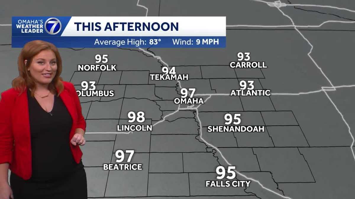
Hot, steamy Friday for Omaha area
Hot temperatures and high humidity continue to end the week and for the weekend. A heat advisory remains in effect until 7 p.m. Saturday. Meteorologist Caitlin Harvey has the fore…
Stories are matched to places by what they name: a city and state, a county, a ZIP code or the publisher's home area. Headlines open on the publisher's site.
Local services in Omaha
+ Add a businessNo businesses are listed for Omaha yet.
Know a plumber, mechanic, food truck or shop that works here? Add it and it appears after a quick review.
ZIP codes for Omaha
More places in Douglas County
Omaha within Nebraska
Local advertising
Reach people looking at Omaha
A paid spot on this page, run through SpiderTaz Network local advertising. Free business listings stay in Local services.