
City Amelia County · Virginia
Jetersville, VA
37.3176°N78.1040°W
- Primary ZIP
- 23083
- ZIP codes
- 1
- Nearest place
- Amelia Court House 8.5 mi ENE
- Local time
- EDT · Saturday
- County
- Amelia County


About Jetersville
Nearby places
- Amelia Court HouseAmelia County · ZIP 23002 8.5 mi ENE
- BurkevilleNottoway County · ZIP 23922 9.9 mi SSW
- RicePrince Edward County · ZIP 23966 10 mi WSW
- CreweNottoway County · ZIP 23930 10 mi S
- NottowayNottoway County · ZIP 23955 13 mi S
- CumberlandCumberland County · ZIP 23040 15 mi NNW
- MannboroAmelia County · ZIP 23105 16 mi ESE
- FarmvillePrince Edward County · ZIP 23901 17 mi W
- BlackstoneNottoway County · ZIP 23824 17 mi SSE
- Green BayPrince Edward County · ZIP 23942 17 mi SW
- WilsonsDinwiddie County · ZIP 23894 20 mi SE
- MoseleyChesterfield County · ZIP 23120 20 mi ENE
- PowhatanPowhatan County · ZIP 23139 21 mi NE
- MeherrinPrince Edward County · ZIP 23954 22 mi SW
- CartersvilleCumberland County · ZIP 23027 22 mi N
- Hampden SydneyPrince Edward County · ZIP 23943 22 mi WSW
- AmmonDinwiddie County · ZIP 23822 23 mi ESE
- FordDinwiddie County · ZIP 23850 24 mi ESE
- VictoriaLunenburg County · ZIP 23974 24 mi SSW
- ProspectPrince Edward County · ZIP 23960 24 mi W
Weather in Jetersville
Getting the latest National Weather Service report for Jetersville…
You can also open the forecast on weather.gov.
News for Jetersville
-

Elsewhere in Virginia
23 things to do in Richmond in September, from Iron Blossom to the State Fair
Richmond is buzzing with amazing events this September from the Chesterfield County Fair’s classic rides and fried foods to the lively Lebanese Food Festival offering traditional …
-

Elsewhere in Virginia
25 things to do over Labor Day weekend in Richmond
Labor Day is the unofficial end of summer, and there are still plenty of ways to spend it around Richmond. From the last public pool day of the season to
-
Elsewhere in Virginia
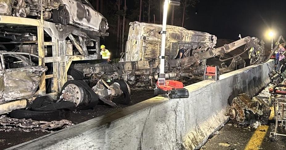
Driver of car hauler dies in fiery crash on I-64 in New Kent
Virginia State Police said troopers responded at 1:30 a.m. to a crash at the 220-mile marker on westbound I-64 near the Bottoms Bridge exit.
Stories are matched to places by what they name: a city and state, a county, a ZIP code or the publisher's home area. Headlines open on the publisher's site.
Local services in Jetersville
+ Add a businessNo businesses are listed for Jetersville yet.
Know a plumber, mechanic, food truck or shop that works here? Add it and it appears after a quick review.
ZIP codes for Jetersville
More places in Amelia County
Jetersville within Virginia
Local advertising
Reach people looking at Jetersville
A paid spot on this page, run through SpiderTaz Network local advertising. Free business listings stay in Local services.