County Massachusetts
Middlesex County, MA
Center of places 42.4539°N71.2981°W
- Places
- 78
- ZIP codes
- 110
- Nearest neighbor
- Suffolk County
- State
- Massachusetts
Places in Middlesex County
 ActonZIP 01718
 ArlingtonZIP 02474
 Arlington HeightsZIP 02475
 AshbyZIP 01431
 AshlandZIP 01721
 AuburndaleZIP 02466
 AyerZIP 01432
 BedfordZIP 01730
 BelmontZIP 02478
 BillericaZIP 01821
 BoxboroughZIP 01719
 BurlingtonZIP 01803
 CambridgeZIP 02138
 CarlisleZIP 01741
 ChelmsfordZIP 01824
 Chestnut HillZIP 02467
 ConcordZIP 01742
 DevensZIP 01434
 DracutZIP 01826
 DunstableZIP 01827
 EverettZIP 02149
 FraminghamZIP 01701
 GrotonZIP 01450
 Hanscom AfbZIP 01731
 HollistonZIP 01746
 HopkintonZIP 01748
 HudsonZIP 01749
 LexingtonZIP 02420
 LincolnZIP 01773
 LittletonZIP 01460
 LowellZIP 01850
 MaldenZIP 02148
 MarlboroughZIP 01752
 MaynardZIP 01754
 MedfordZIP 02153
 MelroseZIP 02176
 NatickZIP 01760
 New TownZIP 02456
 NewtonZIP 02458
 Newton CenterZIP 02459
 Newton HighlandsZIP 02461
 Newton Lower FallsZIP 02462
 Newton Upper FallsZIP 02464
 NewtonvilleZIP 02460
 NonantumZIP 02495
 North BillericaZIP 01862
 North ChelmsfordZIP 01863
 North ReadingZIP 01864
 North WalthamZIP 02455
 Nutting LakeZIP 01865
 PepperellZIP 01463
 PinehurstZIP 01866
 ReadingZIP 01867
 SherbornZIP 01770
 ShirleyZIP 01464
 SomervilleZIP 02143
 StonehamZIP 02180
 StowZIP 01775
 SudburyZIP 01776
 TewksburyZIP 01876
 TownsendZIP 01469
 TyngsboroZIP 01879
 WabanZIP 02468
 WakefieldZIP 01880
 WalthamZIP 02451
 WatertownZIP 02471
 WaverleyZIP 02479
 WaylandZIP 01778
 West GrotonZIP 01472
 West MedfordZIP 02156
 West NewtonZIP 02465
 West TownsendZIP 01474
 WestfordZIP 01886
 WestonZIP 02493
 WilmingtonZIP 01887
 WinchesterZIP 01890
 WoburnZIP 01801
 WoodvilleZIP 01784
Weather in Middlesex County
For the center of the county's recorded places; conditions can differ across the county.
Getting the latest National Weather Service report for Middlesex County…
You can also open the forecast on weather.gov.
News for Middlesex County
-
Names a place in Middlesex County
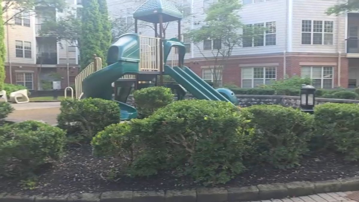
Newton police investigate antisemitic graffiti at playground
Two swastikas and a Nazi greeting phrase were found painted on a playground on Needham Street, according to police in Newton, Massachusetts.
Stories are matched to places by what they name: a city and state, a county, a ZIP code or the publisher's home area. Headlines open on the publisher's site.
Local services in Middlesex County
+ Add a businessNo businesses are listed for Middlesex County yet.
Know a plumber, mechanic, food truck or shop that works here? Add it and it appears after a quick review.
ZIP codes in Middlesex County
- 01431 1
- 01432 1
- 01434 1
- 01450 1
- 01460 1
- 01463 1
- 01464 1
- 01469 1
- 01470 1
- 01471 1
- 01472 1
- 01474 1
- 01701 1
- 01702 1
- 01703 1
- 01704 1
- 01705 1
- 01718 1
- 01719 1
- 01720 1
- 01721 1
- 01730 1
- 01731 1
- 01741 1
- 01742 1
- 01746 1
- 01748 1
- 01749 1
- 01752 1
- 01754 1
- 01760 1
- 01770 1
- 01773 1
- 01775 1
- 01776 1
- 01778 1
- 01784 1
- 01801 1
- 01803 1
- 01805 1
- 01813 1
- 01815 1
- 01821 1
- 01822 1
- 01824 1
- 01826 1
- 01827 1
- 01850 1
- 01851 1
- 01852 1
- 01853 1
- 01854 1
- 01862 1
- 01863 1
- 01864 1
- 01865 1
- 01866 1
- 01867 1
- 01876 1
- 01879 1
- 01880 1
- 01886 1
- 01887 1
- 01888 1
- 01889 1
- 01890 1
- 02138 1
- 02139 1
- 02140 1
- 02141 1
- 02142 1
- 02143 1
- 02144 1
- 02145 1
- 02148 1
- 02149 1
- 02153 1
- 02155 1
- 02156 1
- 02176 1
- 02180 1
- 02238 1
- 02420 1
- 02421 1
- 02451 1
- 02452 1
- 02453 1
- 02454 1
- 02455 1
- 02456 1
- 02458 1
- 02459 1
- 02460 1
- 02461 1
- 02462 1
- 02464 1
- 02465 1
- 02466 1
- 02467 1
- 02468 1
- 02471 1
- 02472 1
- 02474 1
- 02475 1
- 02476 1
- 02477 1
- 02478 1
- 02479 1
- 02493 1
- 02495 1
Neighboring countys
- Suffolk County46 places 13 mi ESE
- Norfolk County45 places 19 mi SSE
- Essex County56 places 21 mi NE
- Worcester County98 places 30 mi WSW
- Plymouth County60 places 39 mi SE
- Bristol County43 places 46 mi SSE
- Franklin County21 places 61 mi W
- Hampshire County17 places 65 mi W
- Hampden County44 places 67 mi WSW
- Barnstable County55 places 73 mi SE
Distances run between the centers of each area's recorded places.